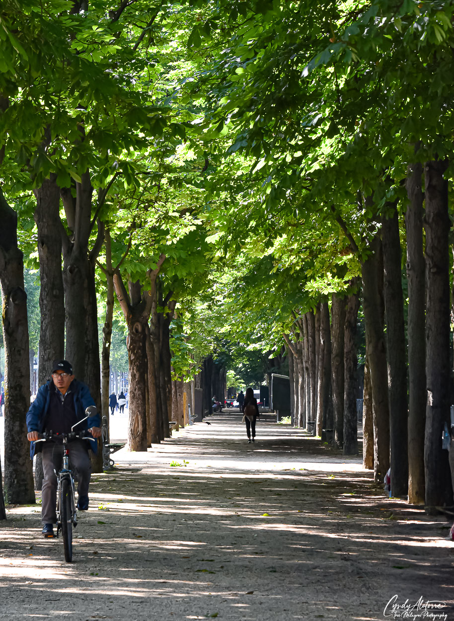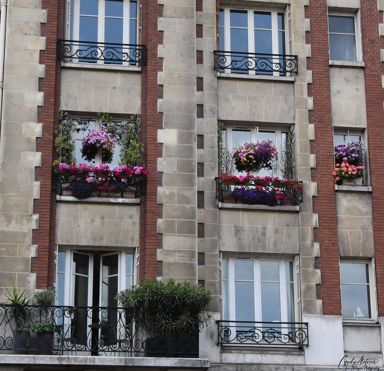

Our first day in Paris gave us a great start to our adventure in this beautiful city. Exploring the city on foot allowed us to get close up to experience life in Paris and soak in some of the city’s atmosphere. This city has so much depth in it history, culture and historical points of interest that it’s easy to keep yourself busy. With still so much to see and explore, we made our way out again into the neighborhoods and headed to our first stop.
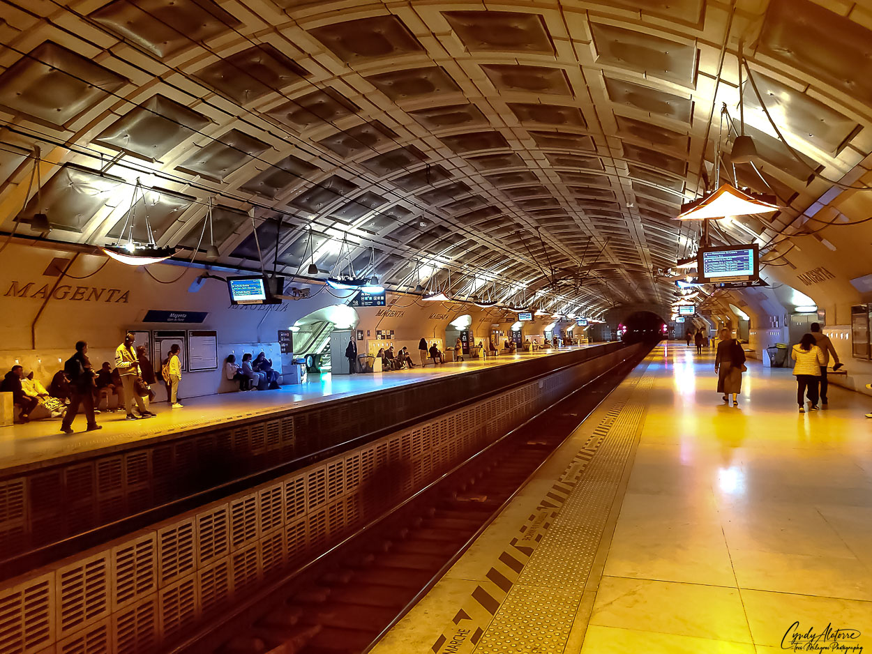
One thing about Europe that a traveler can appreciate is how efficient and well connected its public transportation is. And Paris is no different. The manner in which trains run on time and moves large amounts of people throughout the day is impressive. The Metro runs through out the city and outlying areas and is accessible nearly everywhere. Entering from the street level, you walk downstairs, and soon come across signs to various walkways taking you to different tracks, depending on where you are going. Each metro station was well organized and displayed its personality through its architecture and layout. At some of the stations, the decor would reflect the personality of that area of Paris and was nice to see.
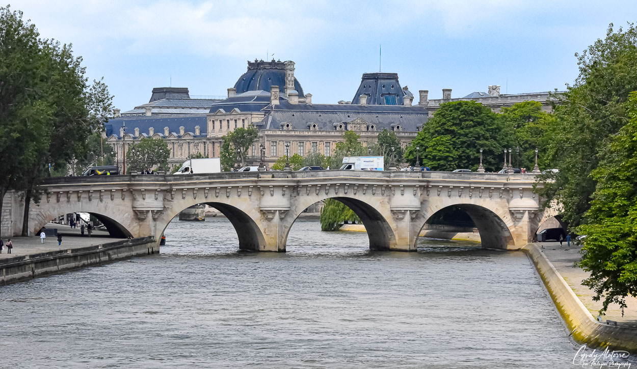
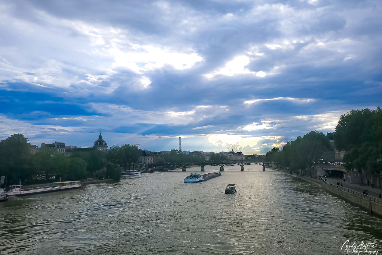
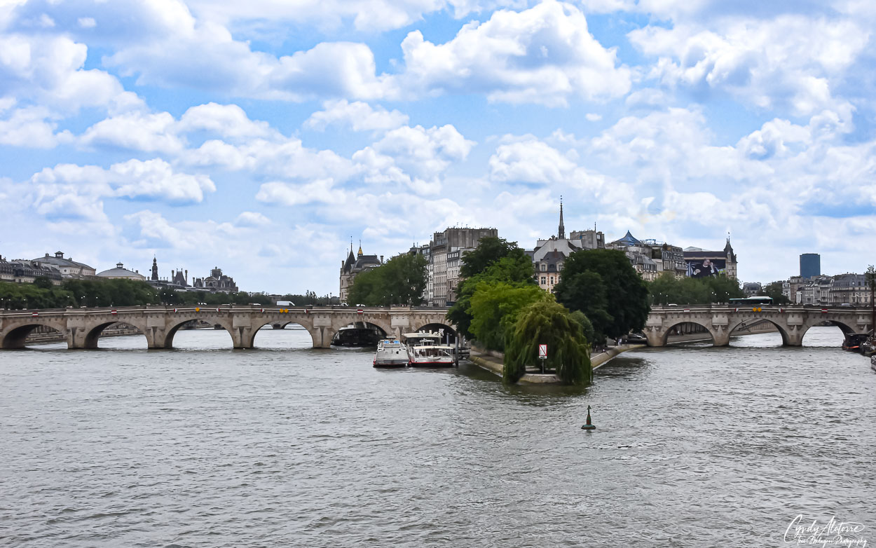
As previously mentioned, there is so much to see in this vibrant and timeless city. With its art, fashion, historic landmarks, and museums to visit and learn from, we started our second day in this city and made our way to Le Louvre. As the Seine River guided us through the city, we came across several bridges that connected the riverbanks throughout the city with one another and allowed traffic and pedestrians to get around. It was interesting to see these old historic buildings and the Seine River coexisting with modern day cars and people on their phone or using their electronic devices. It just showed the versatility of Paris.
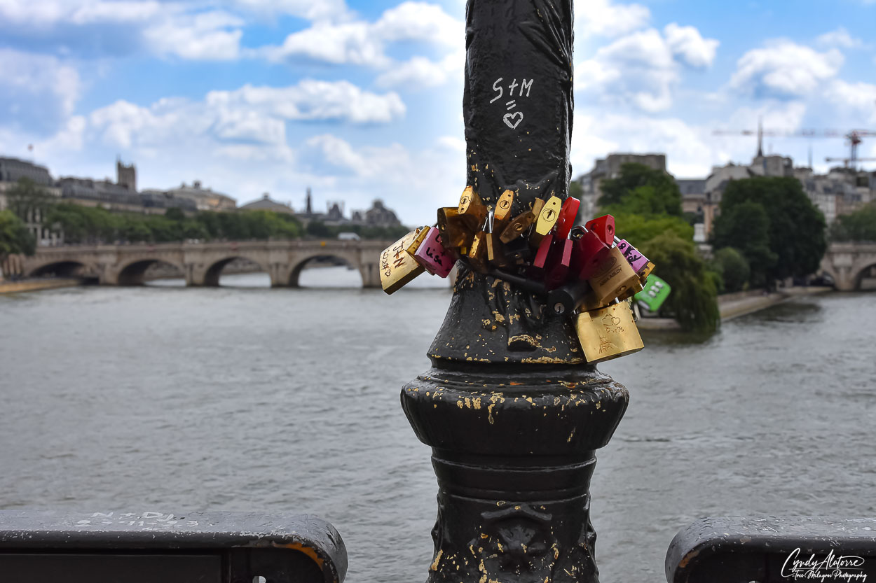
Walking across one of the bridges, I came across several light fixtures that had “love locks” attached to them. This act involves fastening locks together and usually occurs around bridges or waterways. Individuals write their name or initials on a lock, secure it to the fence or structure then throw the key into the water. It’s interesting as I often come across these “love locks” in various city whenever I travel and true to nature, it’s usually around a river or bridge. This act is often seen as a token of romantic devotion of a person’s commitment and love to their significant other and is a public way of showing it. If someone is going to use “love locks” to show their love and devotion, then how appropriate to do so in the City of Love.

Arriving at Le Louvre Museum, you immediately find yourself surrounded by three large and impressive renaissance style buildings. The air around the Le Louvre Museum is of opulence, wealth and strength and that is exactly what King Phillip II was going for when he had it built. Construction of the Le Louvre began in the late 12th century and was built to protect the city from attack, especially as the King of England had control of Normandy at that time. Initially built to serve as a fortress it underwent several reconstructions and eventually became the royal residence until Louise XIV relocated the monarchy to the Palace of Versailles.
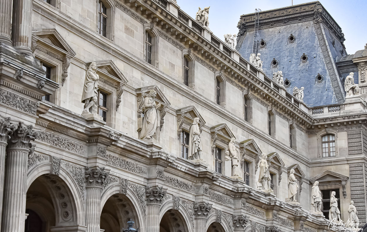

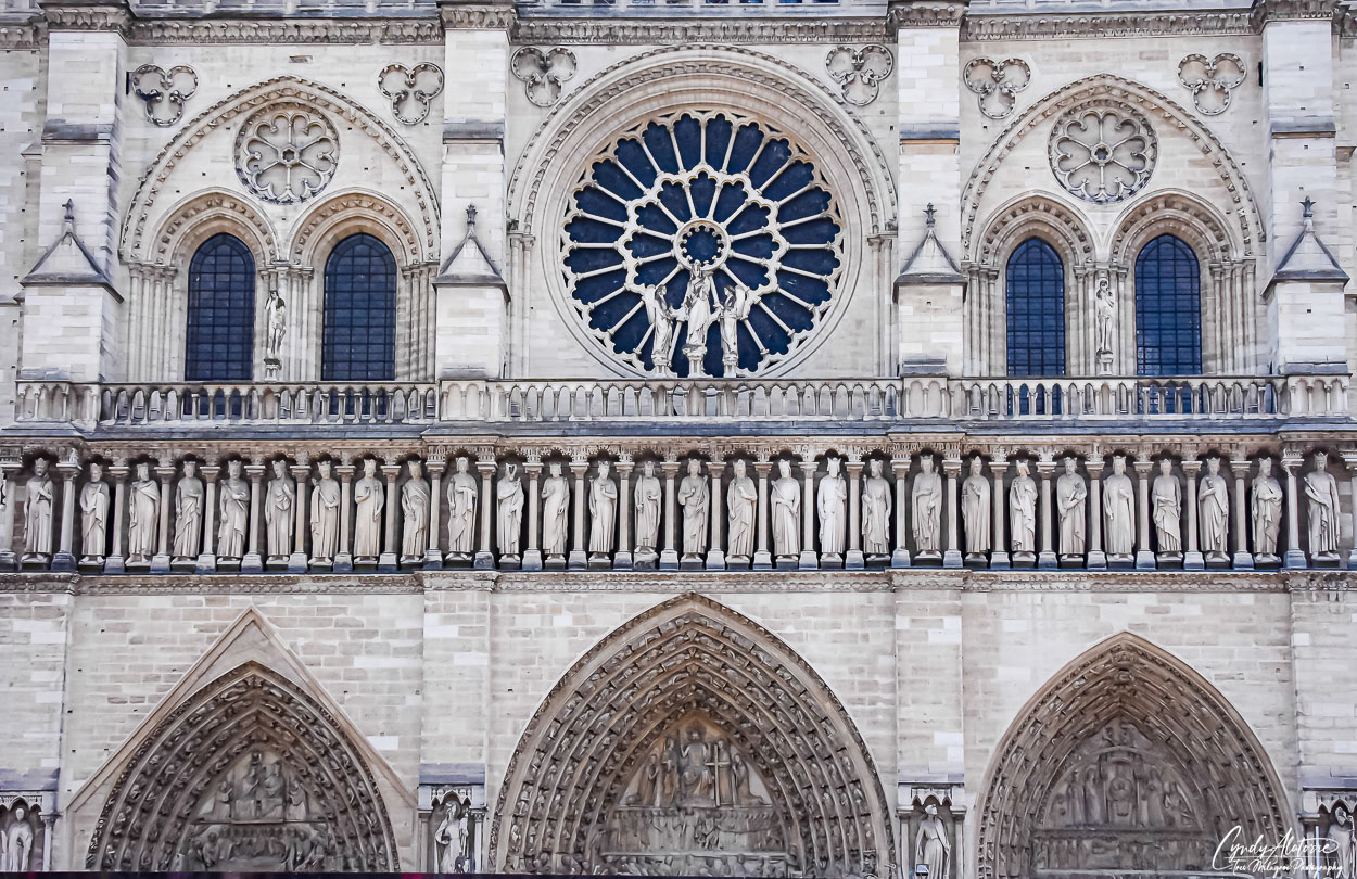
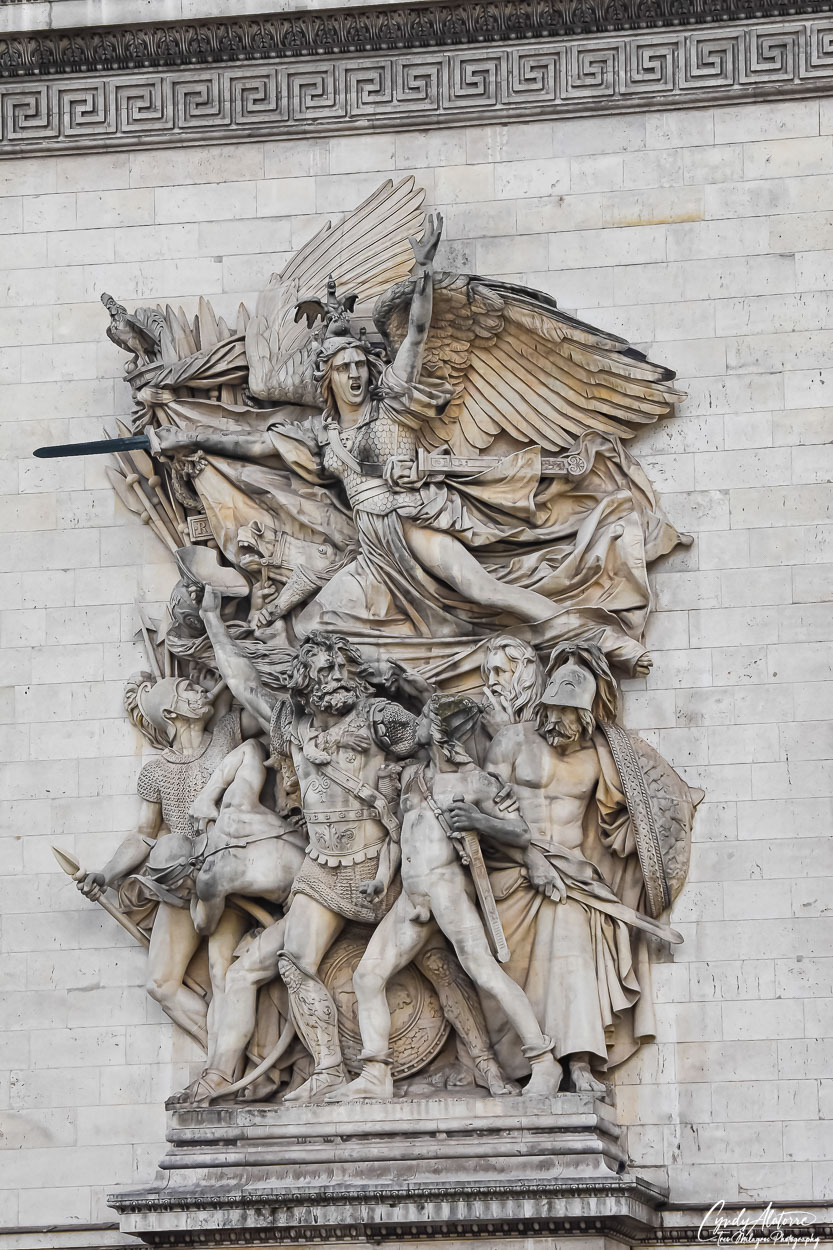
Artwork is not only found inside the museum but greets visitors as they arrive in the courtyard. Sitting along the facade and high on corner walls, intricately chiseled statues keep watch of visitors entering Le Louvre and provides a sampling of the beautiful artwork created during that time period. The number of statues and art pieces displayed within the courtyard and on the buildings was impressive and I marveled at the amount of work and talent it took to create it all.

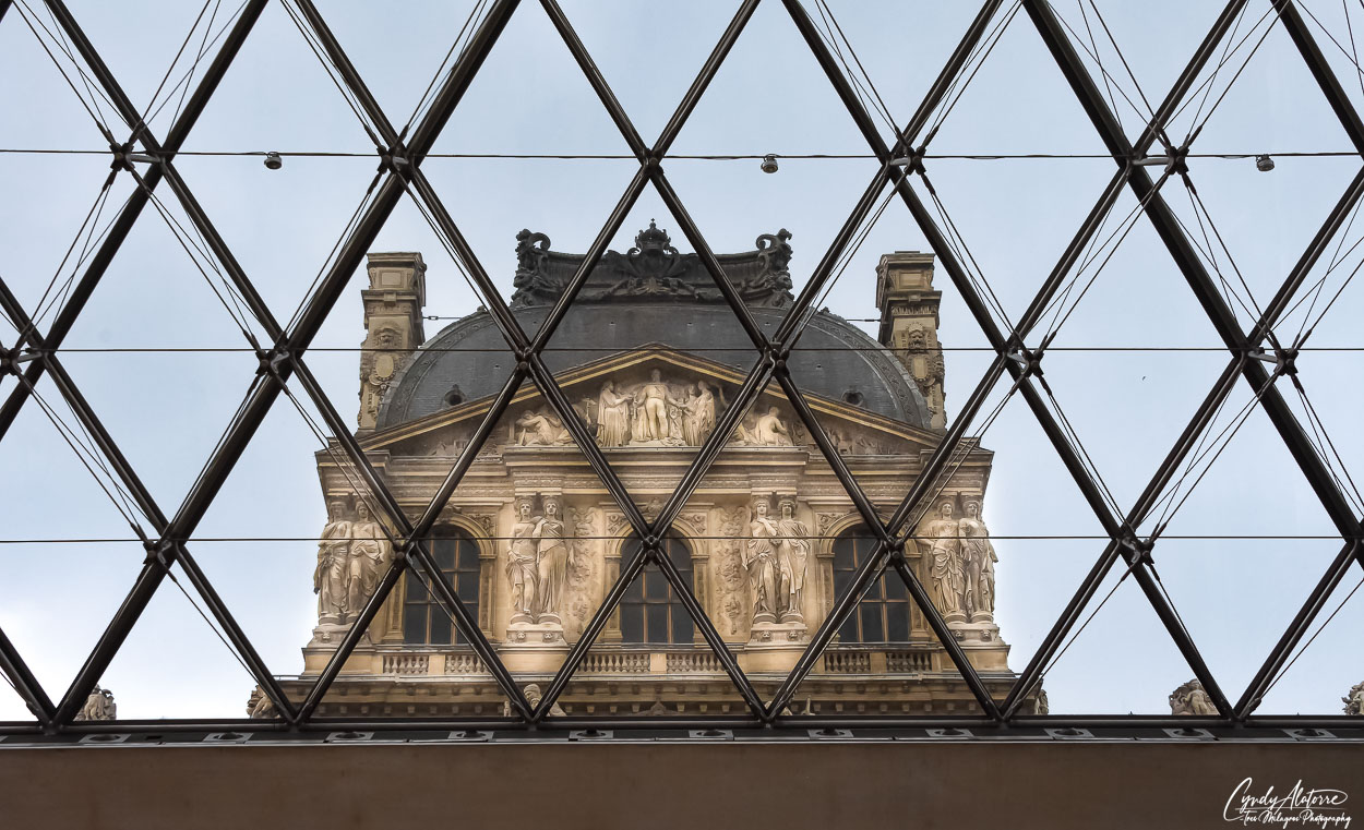
Entering Le Louvre, you go through an iconic glass pyramid that has its own space and contrasts against the surrounding buildings. This 71-foot glass pyramid is made up of 603 rhombus-shaped and 70 triangular glass sections that creates its own unique and artistic space. Unlike other museums, guest descend on an escalator into the underground lobby where they find a bright lobby that connects several wings of the museum. Once below, guest can venture into the various galleries and adjoining shopping and gathering areas .
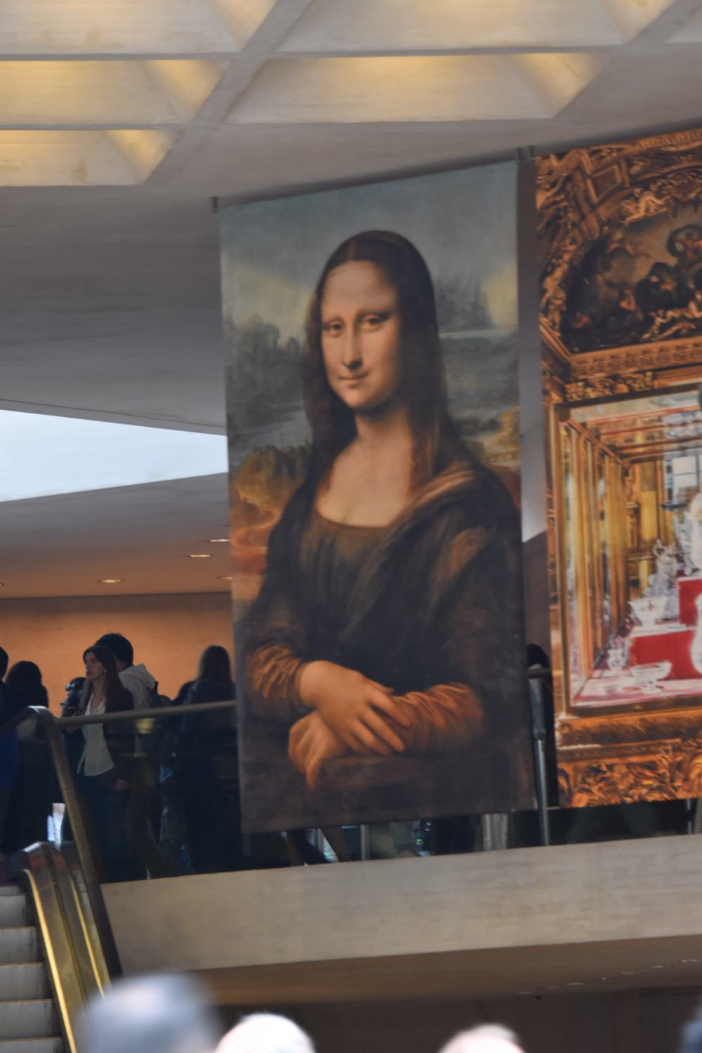


Within the Louvre, there are approximately 500,000 objects with an estimated 38,000 works of art shown at any given time. And of course, I would be remise if I did not mention Le Louvre’s most famous resident.. the Mona Lisa. Displayed in a large gallery, she is given ample space for all her admirers to come and see her portrait. Sitting relaxed with her arms folded across her lap and looking slightly to the left, her gaze and slight smile gets your attention. Perhaps it’s the simplicity of her look or the mystery of not knowing what she was thinking in this pose. No matter, she is beautiful, and it is easy to see why she is so famous throughout the world. She is an icon for the ages.

Le Louvre is an impressive museum, and a person could spend several days exploring and seeing all the works in residence. The talent and foresight to create these impressive works is staggering and one art piece that specifically stood out to me was the “Winged Victory of Samothrace”. She is prominently displayed in the Daru staircase of Le Louvre and is one of its most famous sculptures. In her stance, the winged goddess Nike proclaims victory, is seen just as she is about to descend off a boat. I took this photography in black and white to capture its depth and appreciate the balance of the feminine and strength in this stance. The head and appendages were damaged and lost many years ago, however, seeing this beautiful sculpture now, you would not know any different and its presence is powerful.
This museum is a great excursion and I enjoyed it just now as much as I did on my previous visits. Aside from being the largest museum in the world, it is one of my top five favorites when visiting Paris. Le Louvre is so popular that it even beats the Vatican in visitors and hit 8.9 million guests last year. It is definitely one of Paris’ cultural treasures so if you travel to this wonderful city, definitely put it on your list of “must see’s”. You will not be disappointed.
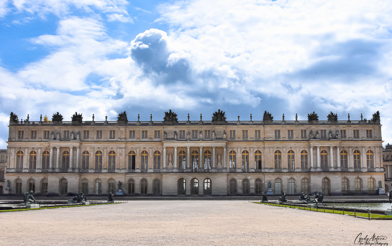
Our next stop in visiting France’s cultural treasures was the Palace of Versailles. Located approximately 30 minutes outside of Paris, we took the RER train to see this spectacular palace. As previously mentioned, the royal family resided at Le Louvre for many years until King Louis XII had Versailles built in 1623. What started as a simple hunting lodge quickly grew to an expansive estate when King Louis XIV assume the throne. 700 rooms, 60 staircases, and 1200 fireplaces later, the Palace of Versailles became known as a center for French politics, culture, and art and was even envied by other monarchies throughout Europe. It was life at its finest.
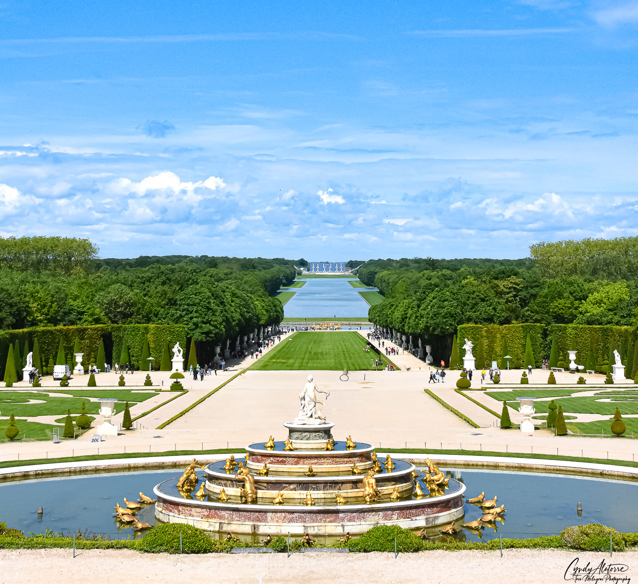
The Palace of Versailles is not only large and decadent with its buildings and furnishing but also encompasses extensive gardens, small villages and buildings apart from the main compound. So just how large is Versailles you ask? Well, its size is 800 hectares which translates to 1,976 acres. Now that is a lot of grass to mow. Within the well manicured gardens, mazes, small lakes and fountains, visitors get the opportunity to enjoy these beautiful grounds and imagine how the French monarchy lived.
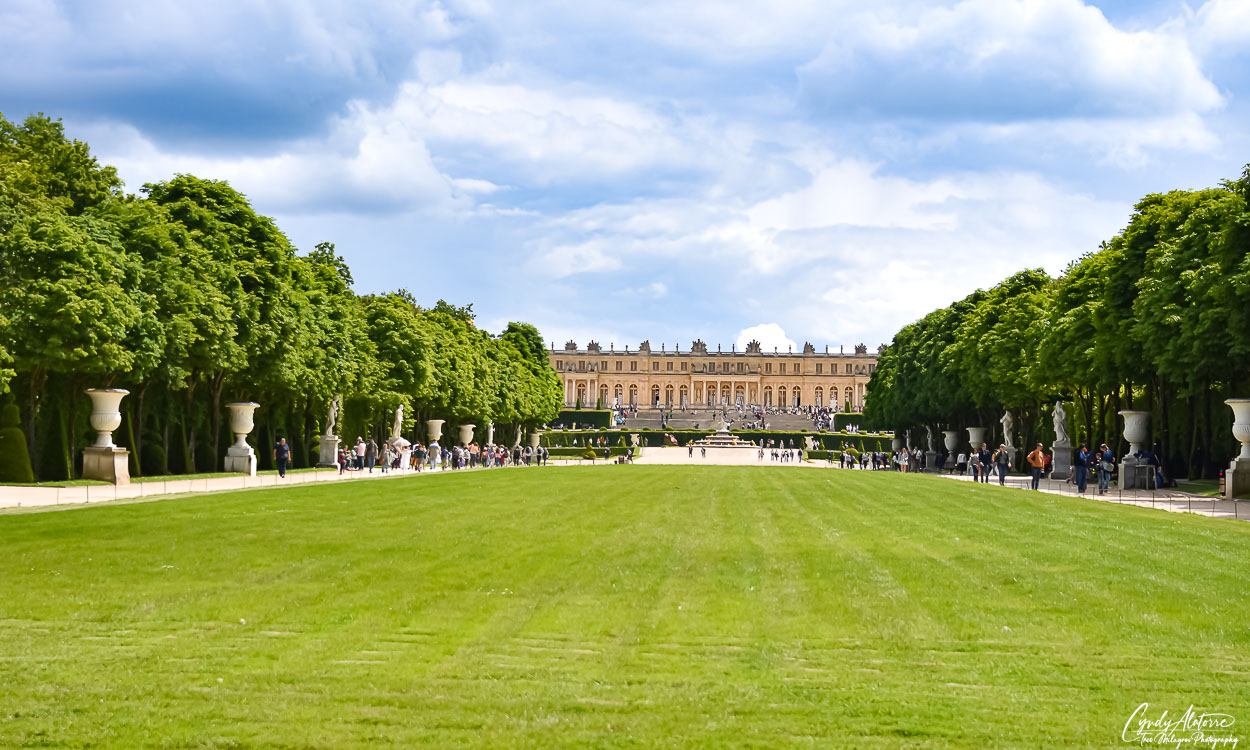
Guests are welcomed to walk the grounds, and you could see people having picnics on the grass areas and renting small boats to go out onto the lakes. Walking around these lush gardens, classical music could be heard being played throughout the area just as it was when the French monarchs lived there. The Palace of Versailles is very beautiful and a person visiting this impressive estate can easily get lost in its calm and serene landscape. These beautiful grounds allow a visitor to get an idea how life was like back in the 17th century as French monarchs strolled the grounds and admired the impressive sculptures located throughout the area. It was a life of beauty, art and privilege.
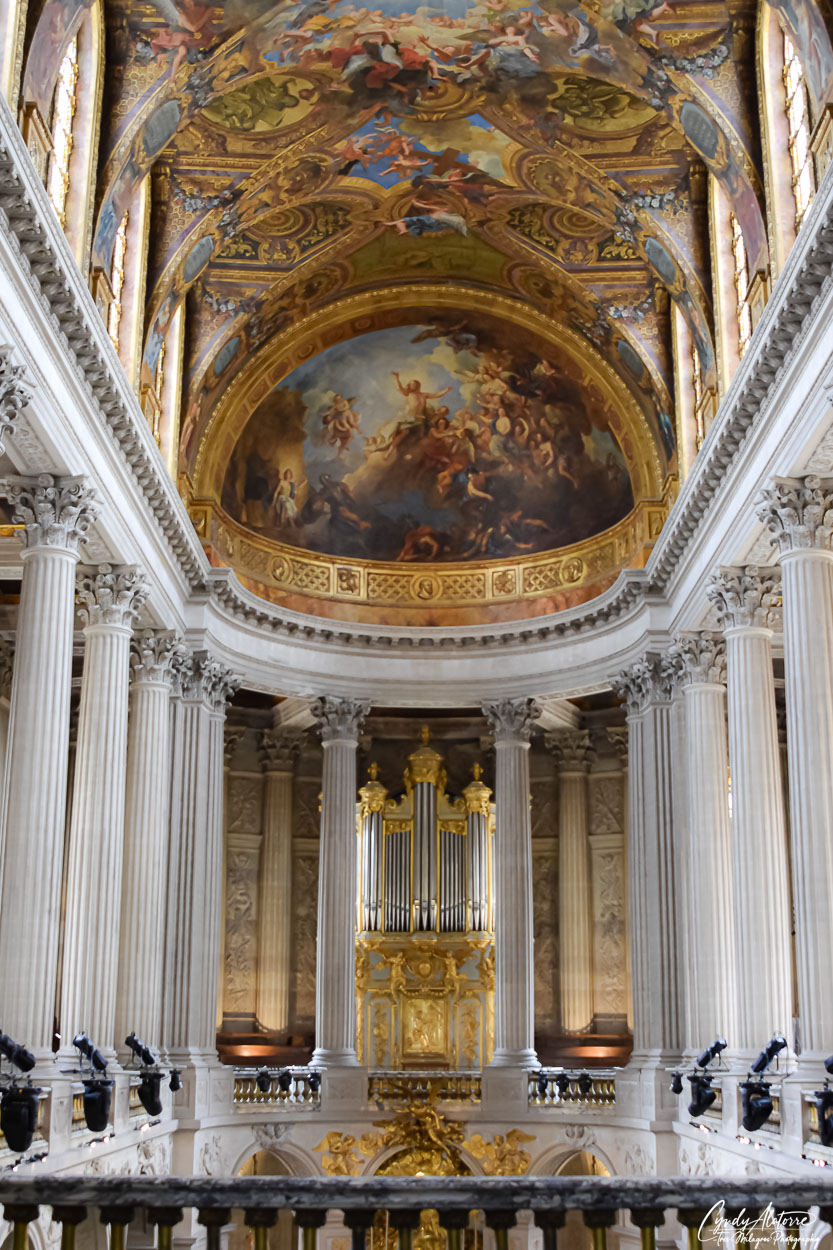
The beauty of Versailles not only is limited to its gardens but is also mirrored within the palace. Inside guests are able to walk through and see the many rooms and witness the opulence of the French monarchy of the 17th century. One of the more well known areas of the palace is the organ of the Royal Chapel. Sitting above the altar in the chapel, the organ is just as extravagant as it is large in size. This chapel is one of five chapels within the palace and was the last one built that was consecrated on June 5, 1710. It was the chapel where many significant events took place such the marriage between the last King and Queen of France, Louis XVI and Marie Antoinette. Above on the ceiling, visitors can see beautiful paintings of celestial scenes taking place along with other heavenly beings painted besides them. Ceiling paintings like these were seen throughout the palace and I like to think of them as spectators who witnessed the ongoings that took place at Versalles. If only the walls, or in this case, ceilings could talk.

Within the palace, you will find many rooms, hallways, and dining areas lavishly decorated. It is fair to say that no expense was spared in furnishing these rooms with beautiful works of art. The talent of the artists and workers that built this palace is evident all around you and it is staggering to think about the amount of manpower, time and expertise it took to create so much beauty.
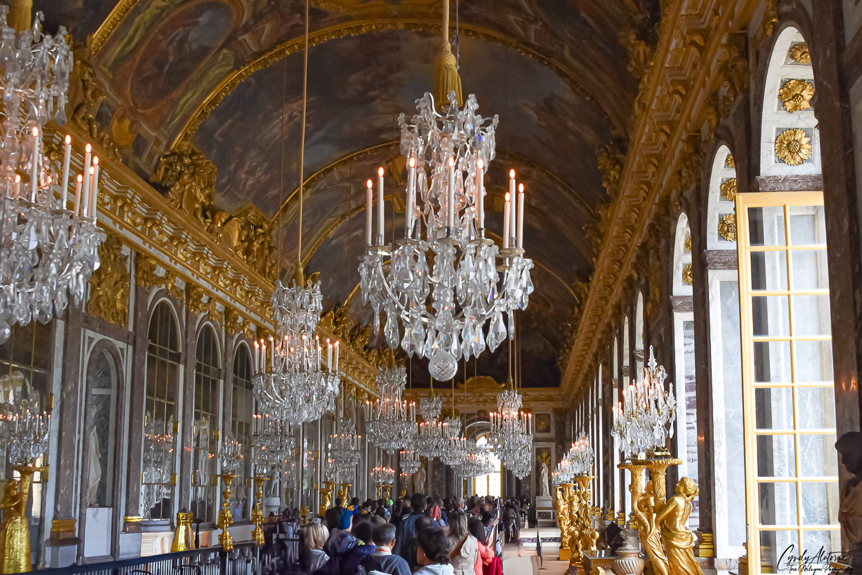
While the Palace of Versailles is known for its beautiful and magnificent estate, it is also known for hosting the signing of the Treaty of Versailles. On June 29, 1919, delegates from Germany and the Allied powers, gathered in the palace’s famous Hall of Mirrors room to sign the peace document that would end World War I. Imagine the combination of these world leaders, from opposing sides, meeting in this lavish room to settle a war and bring peace to the world. It was a momentous event. The history of this room goes back to King Louis XIV who expanded on the design and layout of Versailles and and wanted this gallery to represent the glory of his rein and of France. More importantly, he wanted it to be an outward representation of France’s achievements economically, politically and in the arts.
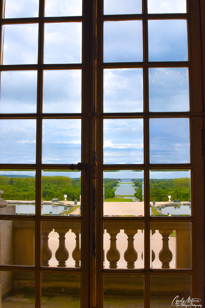
Walking through the hall you get sense of how opulent life must of been. Life was lived on a grand scale and there were no limits. As you continue walking through the hall you can see beautiful views of the gardens through several French doors that lined the West wall of the room. Looking out I enjoyed the scenery and thought to myself that it probably hasn’t changed that much over time. Great efforts have been made to preserve this beautiful palace and they have done an incredible job.
As I wrapped up my visit to these two “Cultural Treasures”, I left with an appreciation to have been able to visit them in person. Visiting these two historic sites felt more like I was going back in time and getting a first-hand lesson in French culture, arts and history. Travel provides the opportunity to go to different places and gain a broader perspective of life, people and actually see where history has taken place and for me that is invaluable. And so with that , I said “A Dieu” (farewell) to these two historic sites, with greater insight for this rich French heritage and a few more “bucket list” locations visited.
Until next time, we’ll keep moving on and see where we go via El Camino Thru My Lens.